Ove Lindholt Hansen
Solmarksvej 20
DK8240 Risskov
Registration with mobile device
GIS is about maps - putting information on a map and displaying data on a map. And that's what GIS4Mobile does.
GIS4Mobile develops systems for mobile data collection - with maps and GPS.
Regarding registration , supervision , quality control and documentation or other similar tasks - GIS4Mobile is the most flexible and user-friendly tool for the task.
GIS4Mobile is also a great tool for bringing your data to the field - data can be published and made available to mobile users, to view or correct and update.
Recording is rewarding - With a mobile solution you document situations and inventory on the spot as a specialist. And with GIS4Mobile, the information is stored forever.
Offline app > Productivity > Design form > Registration > Export GIS data >
Get the free demo now or register for a company account.
Contact us to get started now. Or call +45 40 10 10 91
Danish visitors:
Please go to the danish site to read about
LedningsINFO and LER Robot
and more.
Partners wanted
Would you like to become a GIS4Mobile partner? You will be able to sell GIS4Mobile solutions, and make money servicing your local customers.
Contact us and ask for details.

Read more
You can continue to read about GIS4Mobile, or you can contact us to discuss your needs. Call now +45 40 10 10 91 - or write to mail@gis4mobile.com ,or simply use the contact form.

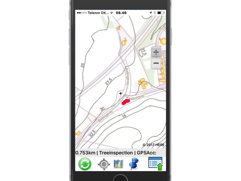
Map canvas
In GIS4Mobile, you always work with a map canvas.
You can choose from the wellknown maps from Google, HERE Maps or OSM.
Danish users can use public maps made available by the government.
Your own maps can also be used, just made available through the WMS standard.
GIS4Mobile can help set up background maps that combines data from multiple sources.
GIS4Mobile 'the movie'
See this small movie to understand the purpose of GIS4Mobile. The user takes a few seconds of registration with image and other information. The registration is automatically saved online, and later it can be displayed on a card at the office.

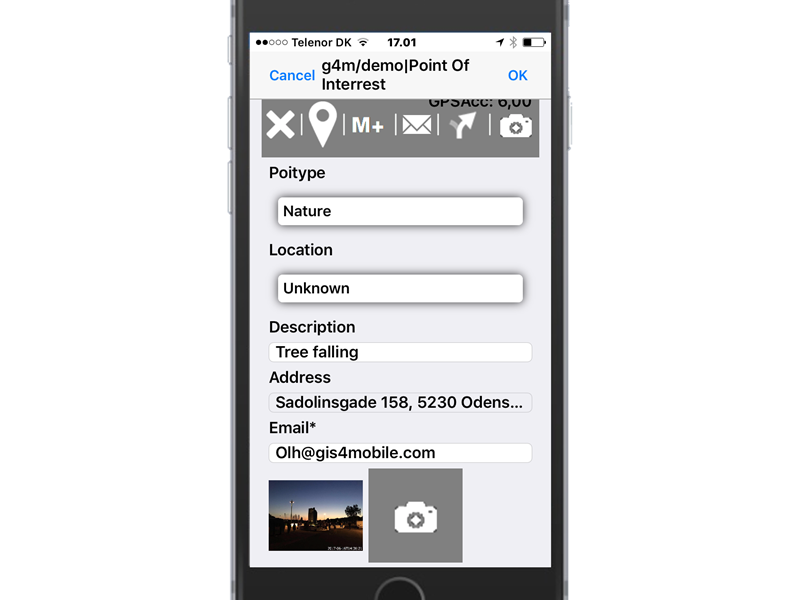
Data registration
In GIS4Mobile, information is entered in forms designed specifically for each theme. There are many types of fields in the form:
- textboxes
- dropdown lists
- multi selection lists
- checkboxes
- date fields
The fields may be required - ie it must not be left empty.
You can design your own forms that fit exactly your task.
Information such as the nearest address etc. can be collected automatically.
GIS4Mobile
